

Main Image: Salvo Community Cemetery (OSA 2023)
October marks North Carolina’s Archaeology Month, dedicated to celebrating the state's archaeological resources. Throughout this month, we offer insights into the identification, documentation, management, and preservation of archaeological sites. As highlighted in our previous blog posts, North Carolina boasts archaeological resources spanning the entirety of its history, both on land and underwater.
As announced last year, the Office of State Archaeology (OSA) is actively engaged in two projects funded by the National Park Service’s Emergency Supplemental Historic Preservation Fund. This fund has supported the state's historic and archaeological resources through addressing the aftermath of Hurricanes Florence and Michael in 2018. These projects encompass both internal state initiatives and external community endeavors (For further details on these projects, check out DNCR’s grants page).
The OSA is currently conducting two projects, assessing and documenting the impacts of hurricanes on shoreline archaeological resources and cemeteries across several of North Carolina’s coastal counties. These initiatives, in the planning stages since 2020, have now entered the exciting phase of fieldwork.
Shorescape Project
The North Carolina Shorescape Project is dedicated to characterizing, documenting, and assessing the impact of hurricanes on archaeological resources in twelve coastal counties (Beaufort, Bertie, Brunswick, Carteret, Craven, Dare, Hyde, New Hanover, Onslow, Pamlico, Pender, and Tyrrell). Given the extensive state-owned and managed lands and numerous archaeological resources within them, a strategic focus was needed.
To streamline this process, a model was developed to rank state-owned and managed lands based on environmental and historical criteria. The model started with an analysis of hurricane and storm surge impacts, utilizing Category 4 storm surge data from the National Oceanic and Atmospheric Administration's (NOAA) Sea, Lake and Overland Surges from Hurricanes (SLOSH) model. This environmental impact assessment factored in the type of underlying sediment in project areas, assigning high priority to parcels that experience a combination of inundation and loose sediment.
Historical analysis involved mapping previously recorded archaeological resources and potential sites using historical maps and archival data. Areas with a high number of recorded sites or potential for new discoveries were given priority. These analyses culminated in a ranked list of state-owned and managed lands, guiding the selection of project locations.
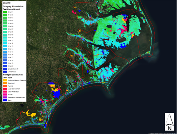
The chosen project locations include the Alligator River Game Land parcels in Tyrrell County, the Scuppernong River Section of Pettigrew State Park Dedicated Nature Preserve in Tyrrell County, and Hammocks Beach State Park in Onslow County. These areas were selected for their substantial environmental risk, a significant number of previously recorded archaeological sites, and high potential for new discoveries.
With the areas defined, the fieldwork was contracted to AECOM, a cultural resource management firm, to complete the surveys. AECOM is currently in the field surveying the different areas for resources, documenting all impacts, and characterizing the shorelines for erosion and accretion. The project comprises three phases: terrestrial survey, submerged survey, and shoreline characterization. The terrestrial survey involves pedestrian surveys and shovel testing within 60 meters of the tide line to identify surface-level and buried archaeological remains and visible structures. The submerged survey utilizes magnetometers, side scan sonar, and sub-bottom profilers to capture images of the submerged bottomlands up to 200 meters from the shoreline. The shoreline characterization phase combines desk-based and field methods, employing visual analysis, photography, and measurements, complemented with long-term aerial imagery and LiDAR to understand shoreline erosion and accretion trends.
Results of this Shorescape Survey project will be added to our Shorescape Survey page as they are gathered!
Historic Cemetery Survey
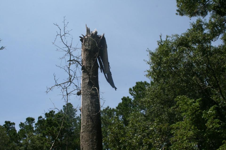
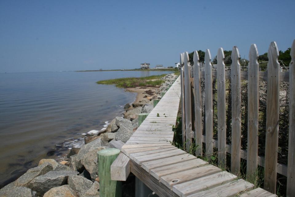
The Historic Cemetery Survey is focused on evaluating the impacts of hurricanes on coastal cemeteries, with the nature of these impacts varying across different coastal counties. Some cemeteries experience damage from storm surge and coastal inundation, while others are more affected by wind damage, such as fallen trees and branches. Understanding these impacts is crucial for developing effective management plans and updating the condition of these resources.
Like the Shorescape survey, this project began by generating a ranked list of state-owned and managed lands through an analysis of environmental impacts and historical priority. The environmental impacts analysis examined Category 4 storm surge and surrounding sediment. Historical priority analysis considered documented cemeteries and predictive resources that would be associated with community cemeteries, especially unmarked enslaved and freed African American cemeteries. Predictive resources included local schools, historic schools, plantations, and African American churches. The combination of these analyses resulted in a ranked list of state-owned and managed lands with impacted cemeteries or a high probability of containing unmarked burial sites.
The project was then split into two sub-surveys. The first aimed to test the predictive capability of the prioritization analysis and was contracted to another professional archaeology company, New South Associates. This involved a desk-based analysis and pedestrian survey of an easement parcel in Brunswick County. The desk-based analysis entailed studying historical maps and aerial imagery to identify potential points of interest, while the pedestrian survey involved on-site exploration to define areas on the ground that might indicate unmarked burials.
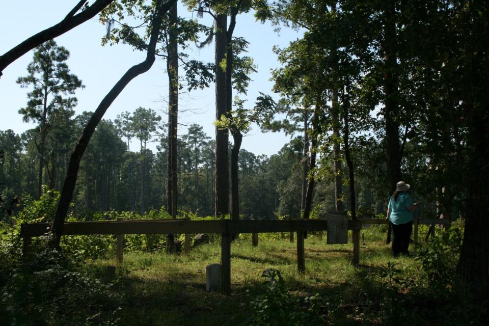
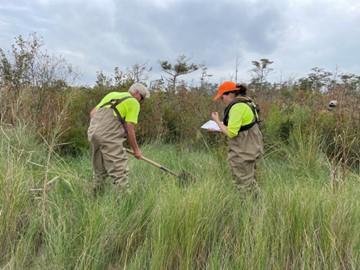
The second survey focused on marked cemeteries, deploying OSA archaeologists into the field to document these sites. The team recorded geographic coordinates for all cemeteries, captured images, transcribed text from headstones, and assessed the disaster impacts on the cemeteries.
Stay tuned for updates on the results of the projects over the next several months and check out our Climate Change page to go more in-depth into the project methods, models, and results.
This material was produced with assistance from the Emergency Supplemental Historic Preservation Fund, administered by the National Park Service, Department of the Interior. Any opinions, findings, and conclusions or recommendations expressed in this material are those of the author(s) and do not necessarily reflect the views of the Department of the Interior.